Workshop round 1 (main stage)From river flows to flood maps – flood related data Presentation by Peter Salamon and Stafania Grimaldi, Joint Research Centre, European Commission. This session focused on accessing the following three flood-related data through the Copernicus image management service: - Hydrological predictions – European Flood Awareness System (EFAS) & Global Flood Awareness System (GloFAS):
Salamon highlighted that available data includes: River discharge, snow water equivalent, soil wetness index, and runoff (surface plus subsurface). He noted that EFAS is the first operational pan-European flood forecasting and monitoring system and supports preparedness for anticipated and ongoing floods in Europe, particularly in large transnational river basins. GloFAS is designed to support preparatory measures for flood events worldwide. - Satellite-based flood maps I: Global Flood Monitoring (GFM)
Salamon stated that available data includes: Observed flood extent, reference water mask (shows permanent water bodies to distinguish them from floodwaters), affected land cover and population, likelihood, and exclusion mask (filters out areas where flood analysis is not applicable). GFM provides a continuous global and systematic monitoring thanks to Sentinel-1 SAR imagery which enables all day and all-weather flood monitoring. - Satellite-based flood maps II: On-Demand mapping:
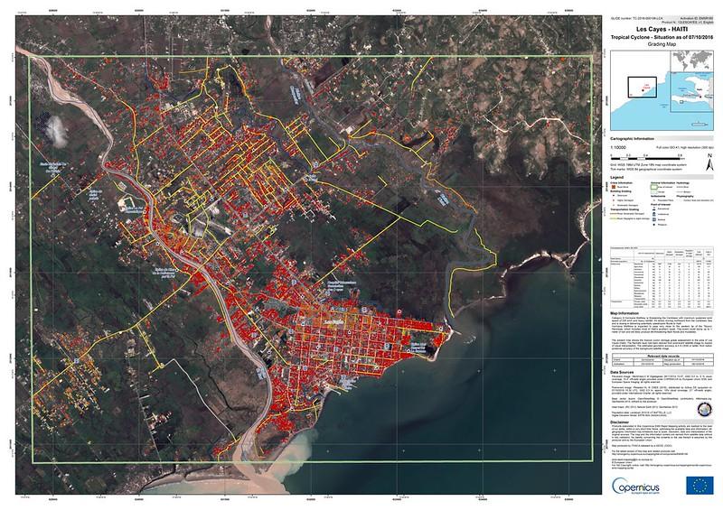
Salamon stressed that available data includes: Observed flood extent, estimated flood water depth, and impact. He further pointed out that on-demand mapping consists of two elements: - Rapid Mapping: Available 24/7/365 for emergency response, offering a standardised workflow and satellite production with delivery in 24-48 hours.
- Risk and Recovery Mapping: Operates during normal working hours, supporting prevention, preparedness, mitigation, and recovery efforts, with delivery in days or weeks.
|