The EU-funded project RASTOOL-DoS (“European Ground Motion Risk Assessment Tools – Downstream Service”) is developing a new ground motion analysis service to strengthen disaster risk reduction and management across Europe.
Funded under the Union Civil Protection Mechanism (UCPM), the project builds on satellite data from the European Ground Motion Service (EGMS) and advanced InSAR techniques to transform millions of displacement measurements into actionable maps and indicators. These products will help Civil Protection Authorities, Geological Surveys, and risk managers detect, characterise, and monitor ground motion phenomena that may affect people, structures, and infrastructure.
A key milestone in this process was the RASTOOL-DoS Online Information Day, held on 6 June 2025, where more than 120 participants from across Europe and beyond learned about the project’s objectives and potential applications. The event introduced stakeholders to InSAR, Copernicus EGMS, the Copernicus Emergency Management Service (CEMS), and the planned functionalities of RASTOOL-DoS. Examples of maps summarising ground motion information linked to natural and human-induced hazards and their potential impact were presented to collect preliminary feedback from the stakeholder community.
Following the InfoDay, as part of Work Package 2 (User Needs and Requirements), a user questionnaire gathered input from 43 participants across 11 countries, mainly representing Geological Surveys (39.5%) and Civil Protection Authorities (30.3%), as well as academic institutions and EU agencies.
This activity provided valuable insights into users’ familiarity with satellite data, InSAR, and Copernicus services.
Most participants already use satellite or remote sensing data in their work (83.7%). Awareness of InSAR is high: 67.4% consider it a useful tool, while 20.9% understand the basics and only 12% reported limited or no knowledge.
Perceptions of Copernicus services were generally positive: more than half (53.5%) rated EGMS products as very useful, while CEMS On-Demand Mapping was known to 48.8% of respondents and had been used at least occasionally by 44.2%.
The survey also explored more technical questions to understand what kind of outputs would be most relevant for daily operations, as visualisation preferences, update requirements, and other expectations.
Types of mapped information
Respondents highlighted the importance of three categories:
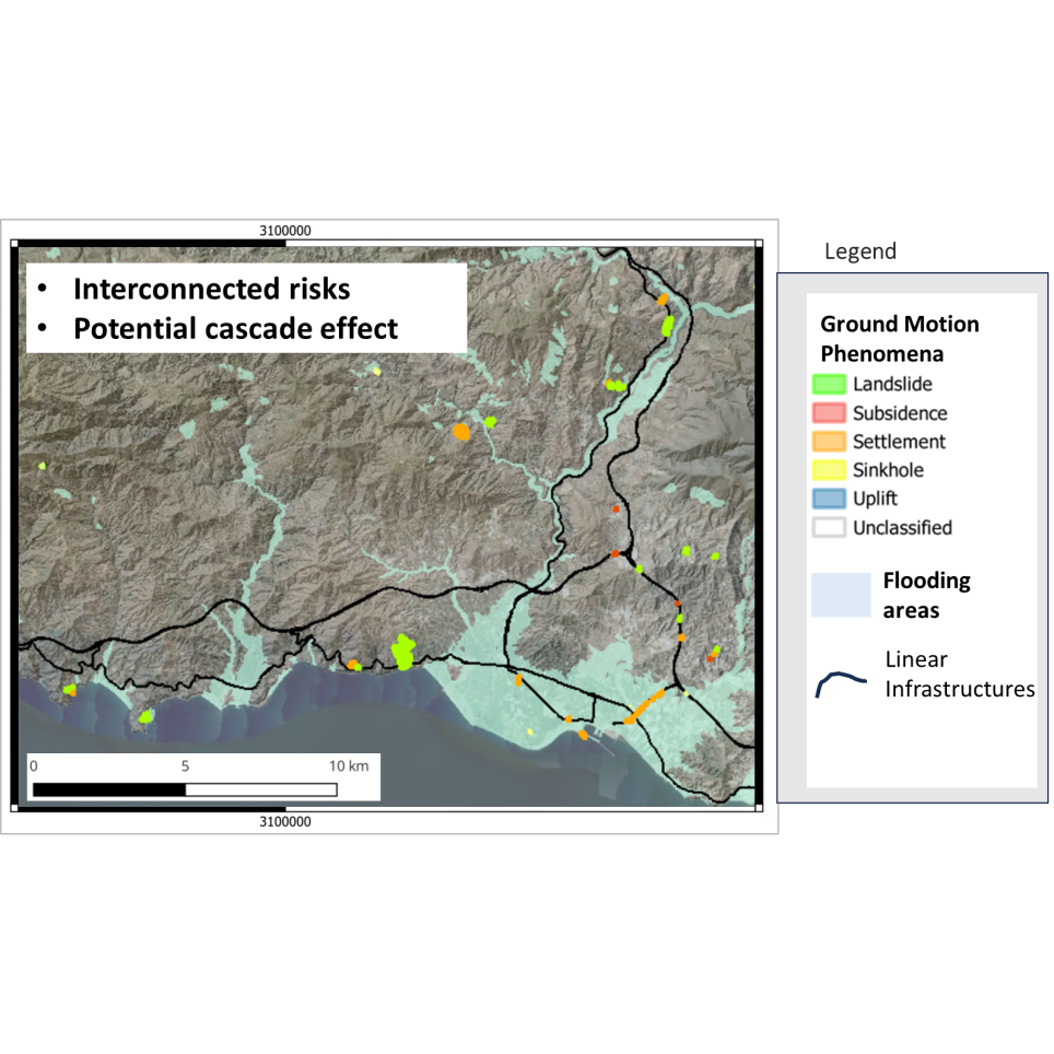
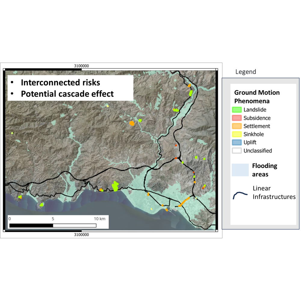
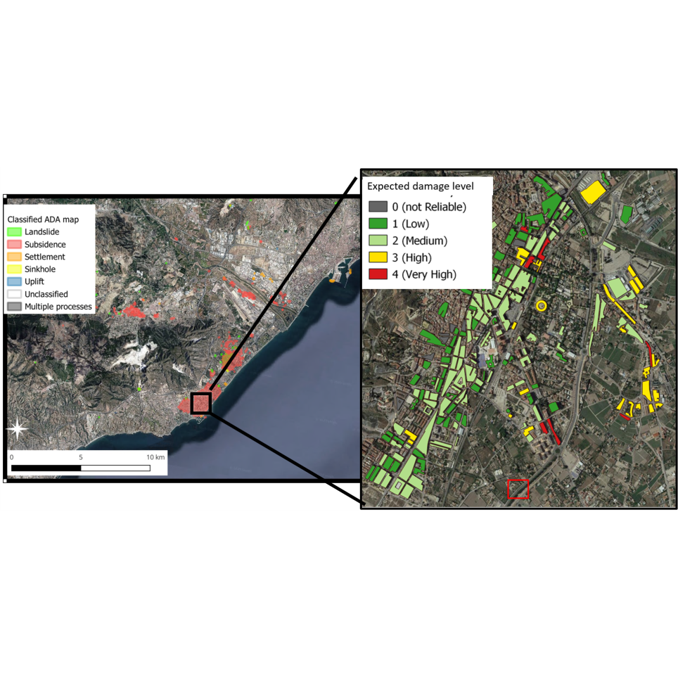
- Impact/Exposure: 65% rated this as most important, emphasising the need to know which structures and infrastructures could be affected.
- Phenomena typology: 63% considered information on the type of ground motion (e.g., landslide, subsidence) highly relevant.
- Velocity/acceleration: 57% valued alerts on how fast or whether movement is accelerating.
Types of summary maps
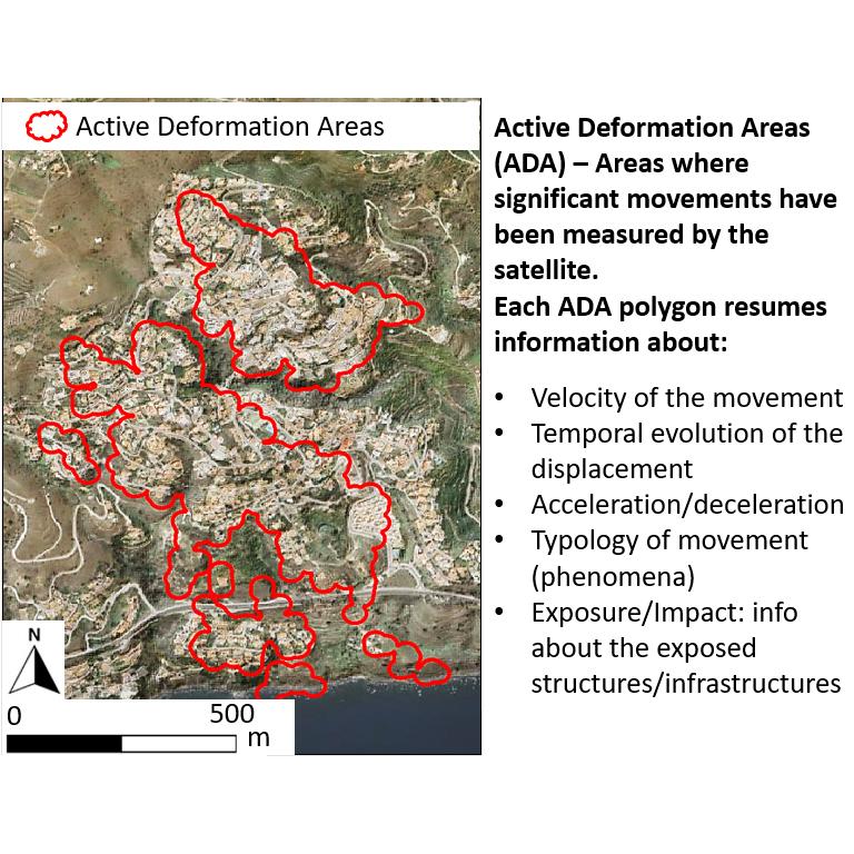
When asked about summary maps, Active Deformation Areas (ADAs) were the clear priority (81%), followed by maps of Exposed Elements (56%). Administrative boundary summaries were considered less relevant (28%).
Map preferences
Most users (55.8%) prefer separate thematic maps for clarity, while 37.2% opted for combined maps, and some suggested toggleable layers.
Update frequency
A majority (55.8%) asked for continuous or on-demand updates, especially in emergencies, while 37.2% said updates with each new EGMS release would be sufficient.
Additional information needed
Respondents stressed the importance of contextual details:
- Time period covered (91%)
- Input data (74%)
- Methodology (70%)
- Quality/uncertainty indicators (56%)
These findings will guide the development of user-friendly products and services within RASTOOL-DoS, ensuring that the prototype ground motion analysis service responds to real operational needs and effectively supports civil protection practitioners and disaster risk managers across Europe.