Premises
From 16 to 18 May 2024, two different activities were performed in Italy as part of the local exercises.
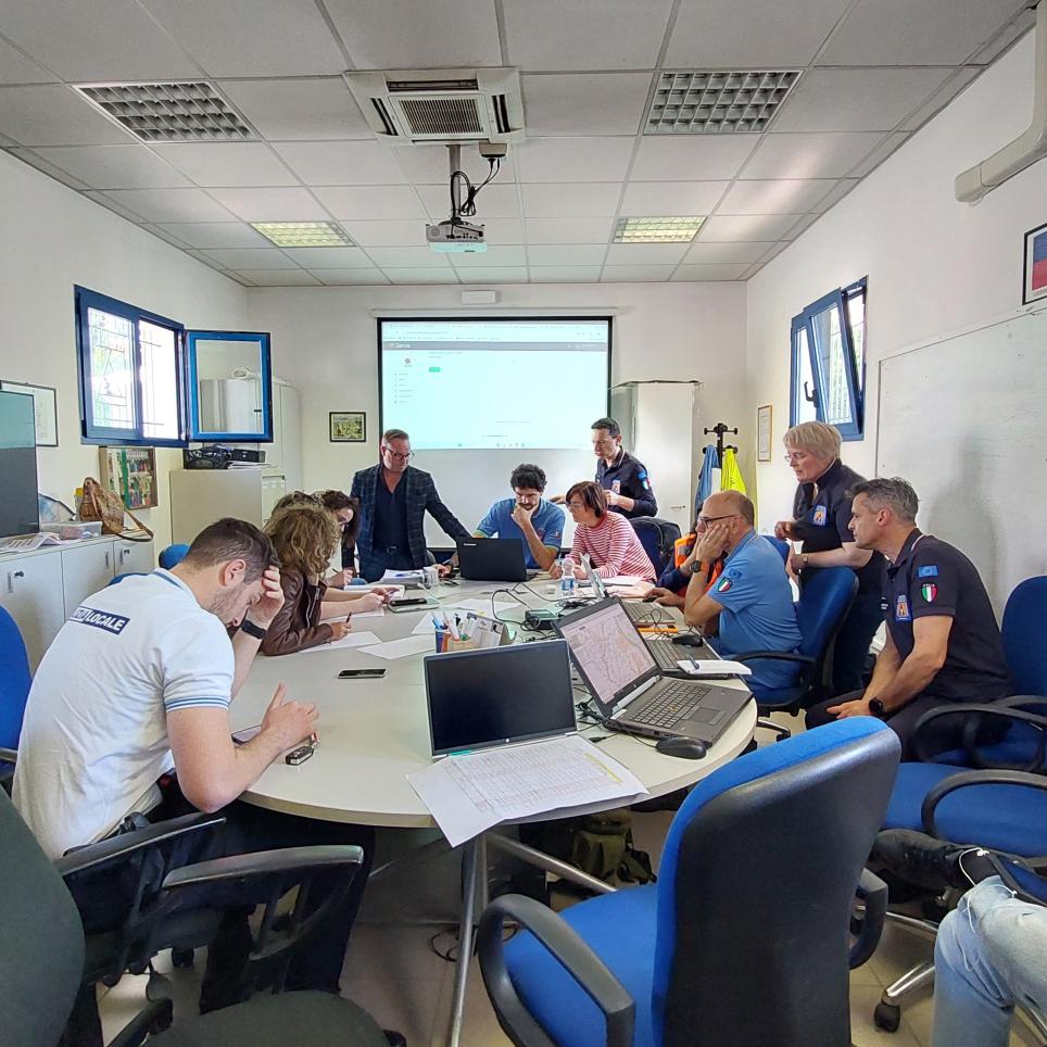
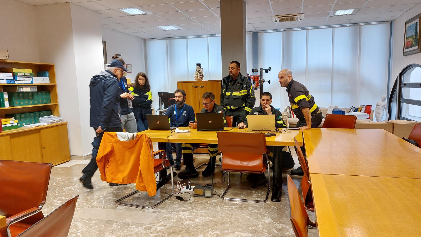
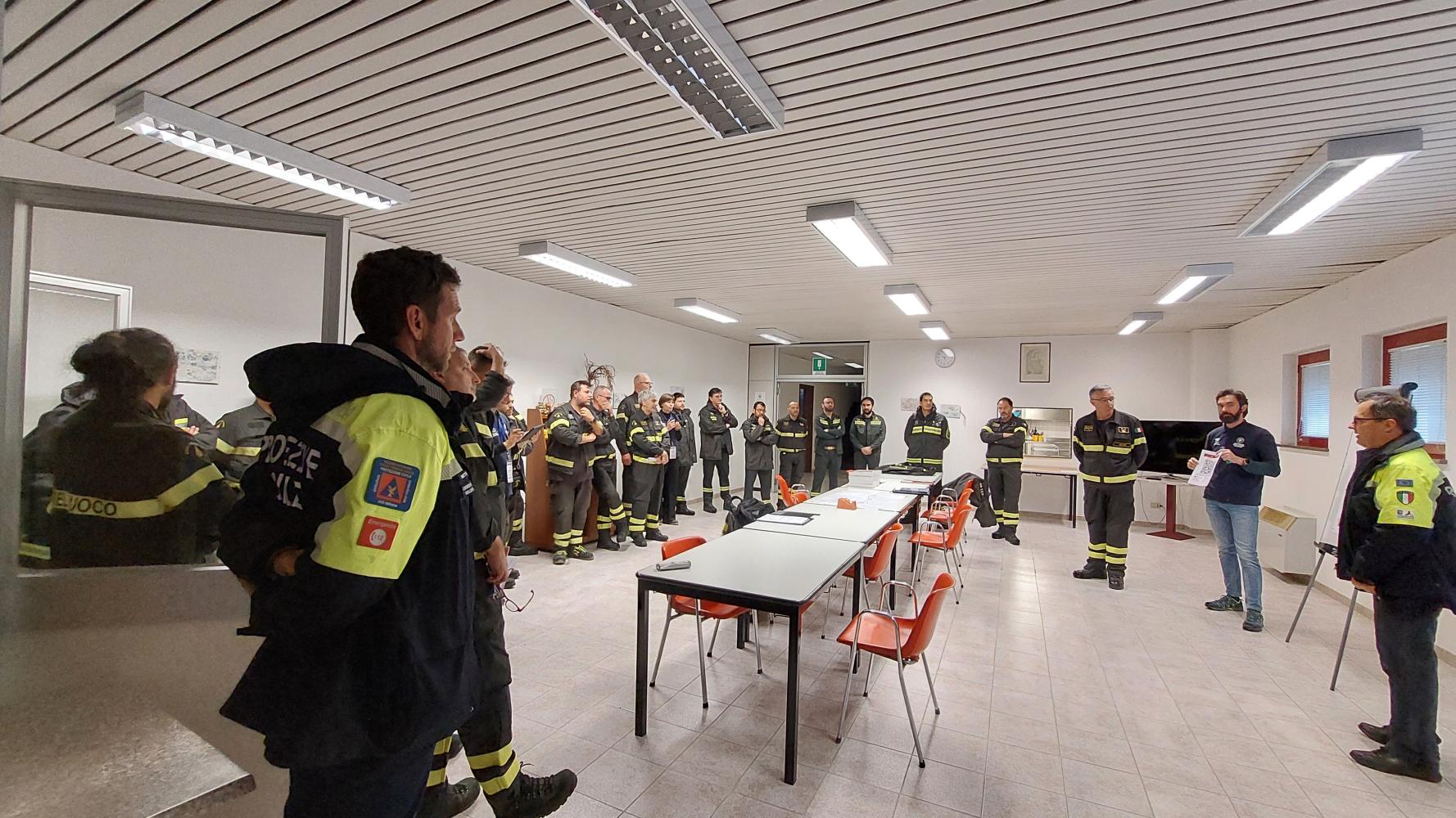
The first activity consisted in a field exercise (SERMex 2024) organized by the SERM Academy (Safety and Emergency Response Mangement international training school), and it evaluated good practices in the context of an earthquake emergency in the city of Venzone, and an hydrogeolical emergency in the municipalities of Montenars, Tarcento, Magnano in Riviera, Artegna.
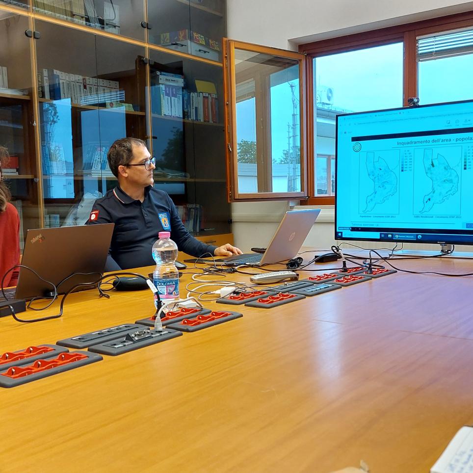
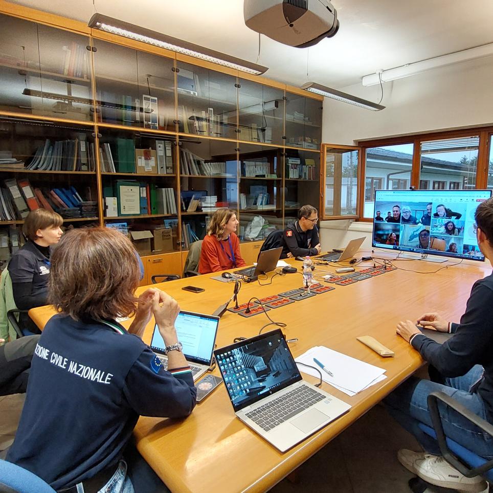
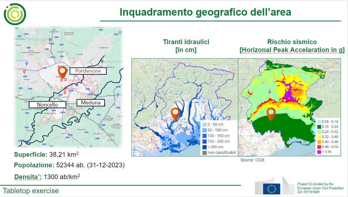
The second activity consisted in a tabletop exercise organised by the ROADMAP2 consortium to evaluate good practices within the context of the multi-hazard scenario (flood and earhquake) in the municipality of Pordenone.
The exercises were attended by Friuli Venezia Giulia Regional Civil Protection, the National Fire Brigade Corps, the University of Udine, the Association of Earthquake-affected Municipalities and Mayors of the Friuli Reconstruction, and the Municipalities of Venzone and Pordenone.
SERMex 2024
The objective of SERMex 2024 exercise was to evaluate the efficacy of the tools and procedures that had been implemented and tested within the SERM Academy activities.
Within the exercise was:
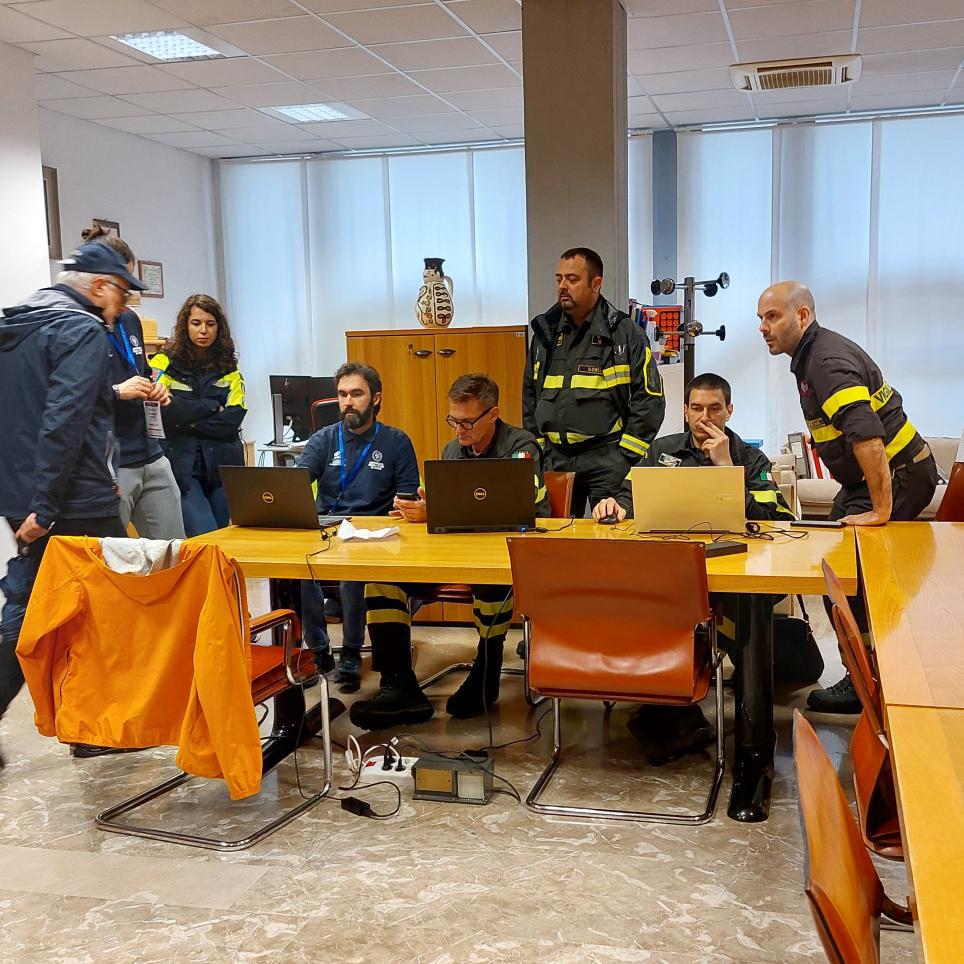
- Simulated an earthquake emergency in the municipality of Venzone, testing the coordination and intervention capabilities of the rescue teams. The operational units worked in realistic simulated scenarios (earthquake magnitude 5.3) to test response methodologies and procedures, aiming for rapid triage of conditions to manage the emergency. In particular, fire brigade teams were mobilised to carry out a preliminary triage of the building. The objective was to identify the areas of the building that had been most severely affected and to establish intervention priorities in order to optimise the use of resources and rescue operations. A school evacuation drill was conducted by pupils at a school in Venzone.
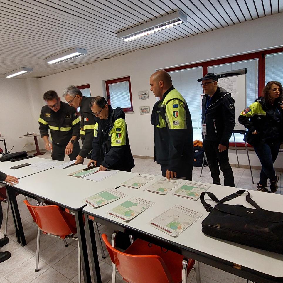
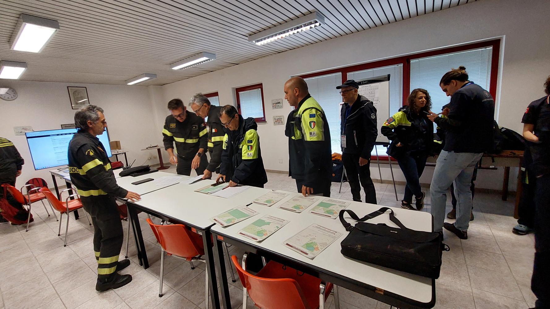
- Simulated a hydrogeological emergency in the municipalities of Montenars, Tarcento, Magnano in Riviera, Artegna, and their hamlets. The mixed fire brigade and Regional Civil Protection teams conducted field surveys using innovative technologies.
- Tested the tools for levee surveillance in the municipalities of Pordenone, Prata di Pordenone, and Pasiano di Pordenone. Regional Civil Protection volunteers simulated real scenarios to improve monitoring procedures.
The exercise was the occasion to observe the following GPs:
- the SERM Academy (Safety and Emergency Response Management International Training School): The SERM Academy was established in 2016 by Friuli Venezia Giulia Region, the Regional Civil Protection, the Italian National Fire Service, the University of Udine, the “Associazione dei Comuni Terremotati e dei Sindaci della Ricostruzione del Friuli” and the Venzone municipality. The Academy takes advantage of the synergic collaboration of the above mentioned actors, and it focuses primarily to meet the training objectives of the Regional Civil Protection and of the National Fire Service, in optics to define an integrated response model. The synergy created with the various partners over the years has enabled tangible improvements in local emergency management. This collaboration has resulted in investments being made in the development of training models and tools that help in emergency management, such as:
- the realisation of Portis Vecchio Training Camp a municipality in which surviving buildings of the 1976 Friuli earthquake, is used as a training ground for technical and operational training for the assessment of structural criticalities and safety in seismic emergency.
- the iTRIAGE approach (engineering of integrated patrol techniques for the management of emergencies) with the aim to arrange procedures, instruments, software and applications in a combined system adaptable to different hazards in order to simplify and to accelerate the management of remote data in the immediate aftermath of an event.
- the SERM-ex exercises geared towards fine-tuning the system and continuously updating the various operators called upon to intervene during an emergency.
- the ‘SERMex Builder’ tool, designed by SPRINT-Lab researchers in collaboration with Regional Civil Protection, is a digital platform for the construction of drills. It employs the use of ‘flags’ with QR codes to present surveyors with images of various scenarios, such as damaged buildings, which are then utilized by the surveyors to contextualize the situation during the survey.
- the compilation of the COPEv (Post-Event Building Operational Control) form, aimed at supporting technicians in the rapid verification of post-event operability (assuming the absence of severe structural and non-structural damage).
- the RECON Suite tool, designed by SPRINT-Lab researchers in collaboration with Regional Civil Protection, is an application for the advanced technical triage of the building and infrastructure for use in both seismic and hydrogeological emergencies.
Tabletop exercise
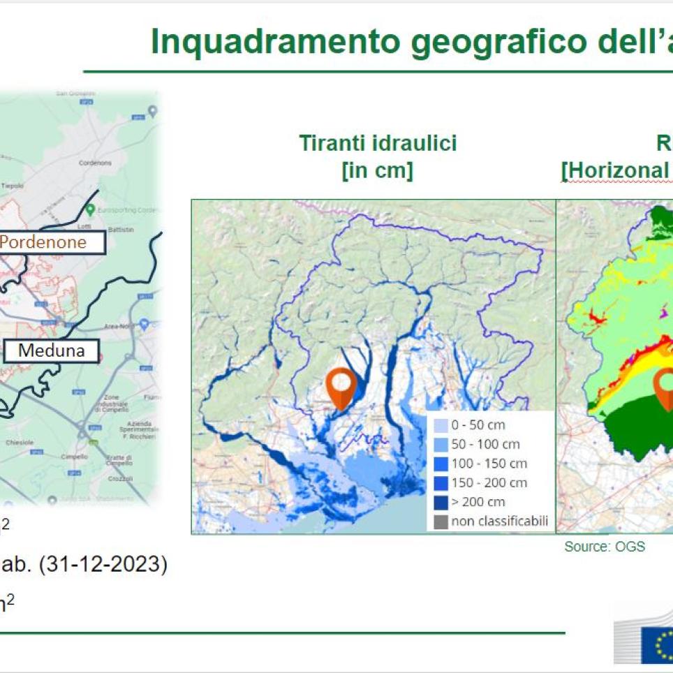
The tabletop exercise looked at an earthquake-flood scenario, occurring in the city of Pordenone, Friuli Venezia Giulia, Italy. The final aim of the exercise was to critically discuss the cascading effects related to the scenario and how selected GPs can help reduce them.
The scenario considered involves a flood caused by the flooding of the Noncello and Meduna rivers, followed shortly by a minor earthquake. Two time intervals between the start of the flood event and the earthquake will be considered: less than 24 hours and more than 72 hours.
The earthquake generates structural damage that is not particularly severe or extensive, however the shaking is such as to induce great concern and panic in the population and the temporary evacuation of most of the population is expected. Based on inspection requests, it may be necessary to carry out structural integrity checks so that tenants can return to their homes.
Difficulties in evacuating the population following both events have been taken into account, with some waiting areas inaccessible due to previous flooding.
Coordination of operations immediately following the earthquake is the element considered of greatest interest.
The exercise was the occasion to observe the following GPs:
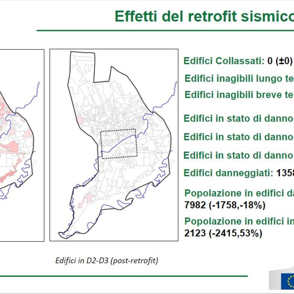
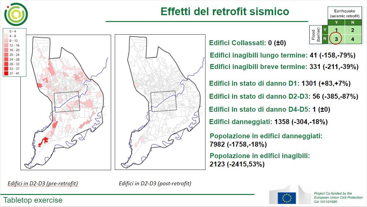
- Building retrofit: This is one of the preventive actions investigated through analytical methods. This action is expected to cause a reduction of the post-earthquake damage. We also expect and increase in the number of people able to return to their homes in a shorter period of time.
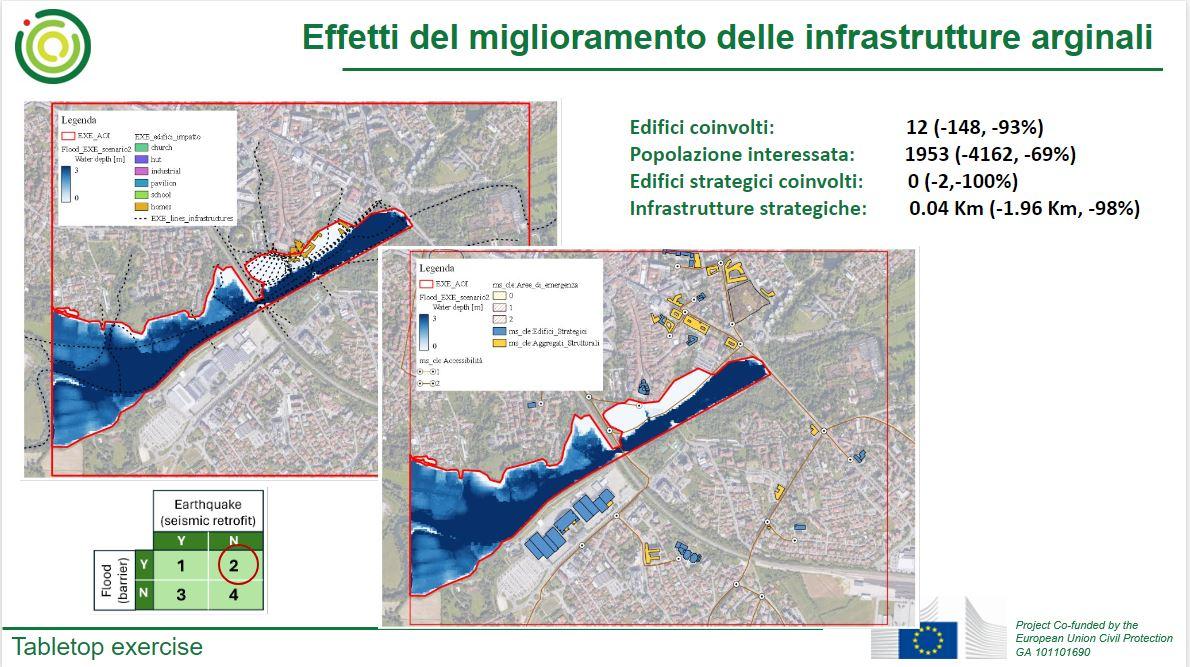
- Installation/retrofit of levees: This is the other preventive actions investigated through analytical methods. This action is expected to cause a reduction of the inundated areas, with consequent reduction of inaccessible roads and increased mobility. In terms of multi-hazard analysis, this action is expected to reduce the number of flooded post-earthquake waiting areas.
- Implementation of IT-alert system: The IT-alert system is an Italian public warning system designed to quickly inform and alert the population in case of emergencies and critical events. It has been recently developed, and concrete benefits have yet to be observed. In general, thanks to the system, the number of people in vulnerable buildings is expected to be reduced. However, due to the specific case considered (previous flooding preventing evacuation of buildings) the benefit may be reduced. These aspects will be discussed during the exercise.
- Multi-risk analysis for the identification of post-earthquake waiting areas at risk of flooding: The participants will discuss how a preliminary study of this multi-hazard aspect may help the community in the immediate aftermath of the events.
- Coordination of response operations: This good practice pertains to the optimization of resources (personnel, equipment, and supplies) for emergency management. The participants will ponder optimal solutions and discuss the expected benefits of a preliminary plan.
- Designation of alternative evacuation routes: Based on the previous discussions, alternative evacuation routes will be identified, and a discussion of the expected benefits will follow. This is classified as an action for response in the attached form. However, it could be considered as an action for preparedness, assuming that the alternative routes are identified before the occurrence of the events.
- Territorial outposts: The practice of “territorial outposts” (“Presidi territoriali” in Italian, DPCM 27/02/2004) is an observational monitoring activity, fixed or itinerant, variable depending on the operational phase (from the pre-alert to the emergency), carried out by operational structures on predetermined critical points, of local or regional interest, in order to identify and report critical situations to the coordination centers or operations rooms and/or competent authorities. At local level, it has been recently implemented in the Friuli Venezia Giulia region, and it basically consists inis the deployment of volunteers to monitor the situation (e.g. flood level, state of the embankments etc.) in particular check-points, known to be flooded in past events, to evaluate comparatively the situation and allow pre-alerting in case of potential critical situation. This practice allows for a real-time adaptation of strategies for response, and it has been successfully implemented in previous events. The participants will discuss the benefits in the context of the investigated scenario.
Acknowledgements
The project consortium would like to extend its gratitude to all participants, with special acknowledgement to the Friuli Venezia Giulia Civil Protection and the University of Udine for their invaluable assistance.