Geophysical risk

Geophysical risk

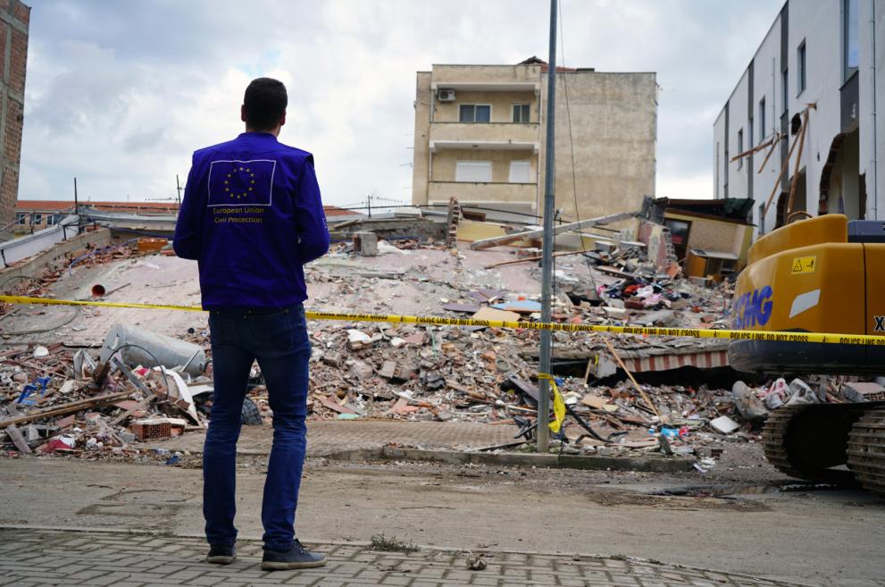
Seismic risk is determined by the combination of seismic hazard, exposure of people and physical assets, and vulnerability of the built environment. Gradual improvement of seismic standards in buildings in most EU Member States has been important in reducing Europe’s vulnerability to geophysical risk, but seismic resilience of buildings remains a serious concern.

Key information

Seismic risk is determined by the combination of seismic hazard, exposure of people and physical assets, and vulnerability of the built environment.

Key risk drivers

Evolving earthquake risk in Europe is driven by vulnerability and exposure.

Exposure has been increasing in Europe over recent decades – between 1975 and 2015, the population potentially exposed to earthquakes increased by 7 %, while the exposed built-up environment increased by 142 %. In 2015, approximately a quarter of the EU’s population and a quarter of its built-up area were potentially exposed to earthquake scenarios with a return period of 475 years.

The gradual improvement of seismic standards in buildings in almost all EU Member States has been an important development in reducing Europe’s vulnerability to earthquakes. However, despite the progress achieved, seismic resilience of buildings remains a serious concern. The majority of buildings in the seismic-prone regions of Europe were designed without provisions for earthquake resistance or following moderate-level seismic codes.

The size of the built-up area in the EU is about 25 billion square metres. Of the current residential building stock, 80 % was built before the 1990s, with 40 % built before the 1960s. A considerable amount is even older and often classified as cultural heritage. JRC analysis shows that the majority of buildings in the seismic-prone regions of Europe were designed without provisions for earthquake resistance or following moderate-level seismic codes.

Impacts and vulnerabilities in Europe

The cross-border dimension of geological risks is taken into consideration by several EU countries in their 2018 Union Civil Protection Mechanism (UCPM) national risk assessments, submitted in the framework of Decision No 1313/2013/EU. Some also report cross-border cooperation in the field (e.g. early detection of earthquakes supported by the Romania–Bulgaria Interreg cross-border cooperation programme).

Compared to the previous risk assessment cycle, several countries include geophysical risks for the first time, while others analyse them in more detail (e.g. more scenarios, historical data, new models).

Seismic risk is determined by the combination of seismic hazard, exposure of people and physical assets, and vulnerability of the built environment. Earthquakes can trigger secondary effects, such as landslides, damage to vital infrastructure, liquefaction of the soil, tsunamis, debris avalanche and fires that sometimes cause more damage than the tremor itself. They can also lead to damage to vital infrastructure and Natech events, such as the release of hazardous materials from damaged industrial facilities.

Considering that it is not possible to avoid the occurrence of earthquakes, volcanic eruptions or tsunamis, nor to fully eliminate the presence of people and property in some hazardous areas, risk mitigation policies focus on:

  • increasing resilience (societal and structural);
  • reducing vulnerabilities (structural, physical and social);
  • minimising the exposure of the elements at risk.

Some Member States mention measures for managing geophysical risk in their national risk assessments. These include methodologies for assessing and mapping the seismic risk, seismic risk awareness-raising measures, training on design and construction of seismic-resistant buildings, and seismic zoning and urban planning. Several good practices emerge, such as the Italian alert system (SiAM) for tsunamis generated by earthquakes in the Mediterranean Sea, the International Airways Volcano Watch system, and UK civil contingency aircraft used for atmospheric testing in the UK airspace.

Earthquakes

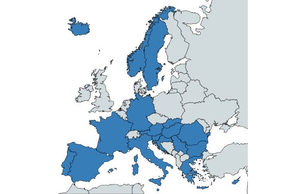
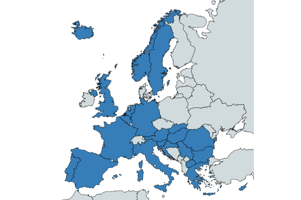
Twenty countries include seismic risk in their national risk assessments. The predicted likelihood and impact of earthquakes varies from country to country, taking into consideration different levels of exposure to the risk, as well as structural vulnerability.

Italy, Bulgaria and Slovenia rate the seismic risk the highest. In 2020, Croatia was struck by earthquakes that also affected its capital, Zagreb.

Earthquake risk in NRAs 2015

Earthquake risk in NRAs 2018/2019

Tsunamis

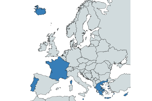
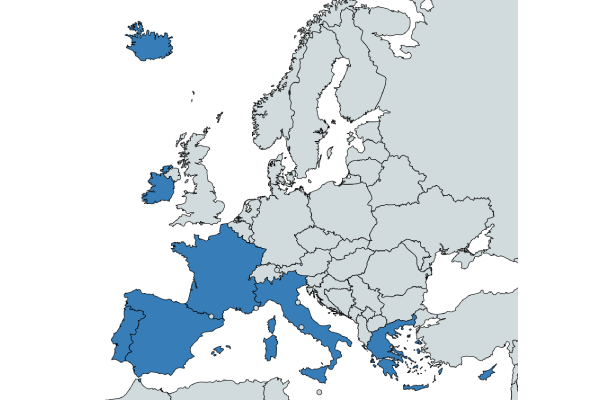
Tsunami risk is assessed more widely than in previous years, with nine countries in Europe including it in their national risk assessments.

Portugal experienced the most destructive tsunami in Europe caused by Lisbon earthquake in 1775. In June 2017, Greece was struck by a tsunami, also induced by earthquakes.

Tsunami risk in NRAs in 2015

Tsunami risk in NRAs 2018/2019

Volcanic eruptions

Six countries in Europe assess the risk of volcanic eruption or volcanic ashes.

About 15 million people in Europe live within just 30 km of an active volcano; of these, more than 2.2 million live within 20 km of the Campi Flegrei caldera in Italy, and more than 675 000 live within 10 km of Vesuvius.

In 2010 Eyjafjallajökull eruption in Iceland that caused large-scale disruptions across Europe. In 2021, the volcanic eruption in the La Palma island lasted 85 days.

Volcanic Risk in NRAs 2015

Volcanic risk in NRAs 2018/2019

Addressing the risk: Policy framework

The European Commission supports the development of European building standards – Eurocodes – of which Eurocode 8 (EN 1998) guides the design of buildings, bridges, silos, tanks, pipelines, foundations, towers, masts and chimneys in seismic areas. These standards allow for new buildings to be better designed and, to a certain extent, existing structures to be renovated and adapted. This ensures that if a geophysical event, such as an earthquake, occurs, lives are protected, damage is limited, and civil protection structures remain operational. Special structures, such as nuclear power plants, offshore structures and large dams, are outside the scope of EN 1998.

According to a JRC report on the ‘State of harmonised use of the Eurocodes’, however, seismic zone maps show discontinuities in the seismic levels at countries’ borders due to different national practices, making it difficult to harmonise the use of Eurocodes in neighbouring regions of different Member States.

Addressing the risk: Supportive measures

Continued action is necessary to achieve higher safety standards in areas prone to geophysical risk. This should include:

  • enforcing and improving building codes;
  • targeted measures to address vulnerability of existing critical infrastructure (e.g. hospitals, schools, emergency units, etc.) and cultural heritage buildings and sites;
  • development of early warning systems; and
  • awareness-raising activities.

The European Regional Development Fund and Cohesion Fund provide significant funding to Member States to enable them to be resilient to and prepared for geophysical risks, as well as for cross-border and transnational cooperation in reducing seismic risk.

The EU Solidarity Fund offers financial aid for emergency and post-disaster reconstruction operations. In 2017–2019, the EU Solidarity Fund supported two Member States, Greece and Italy, allocating over EUR 1.2 billion to deal with damages caused by earthquakes in 2017 and 2018.