Hazards addressed
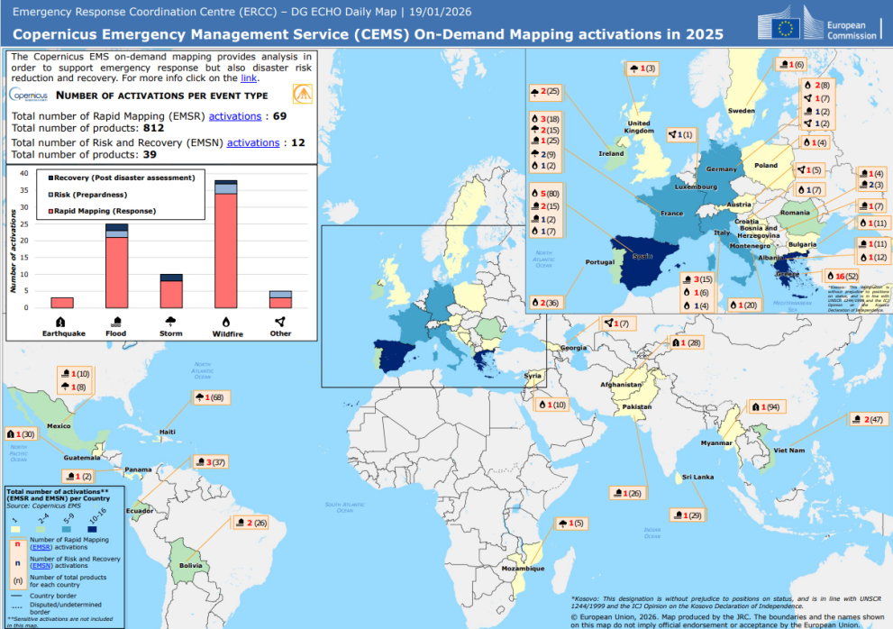
In 2025, CEMS activations responded to several types of hazards, including:
- Wildfires
- Floods
- Storms
- Earthquakes
- Other hazards, as classified by Copernicus EMS
Wildfires and floods accounted for a large share of Rapid Mapping activations, highlighting ongoing climate-related risks and the need for timely information to support response efforts.
Global reach with a strong European focus
CEMS On-Demand Mapping was activated across Europe, Africa, Asia, and the Americas. Within Europe, several countries recorded multiple activations, underlining CEMS’ role in supporting the Union Civil Protection Mechanism (UCPM) and national authorities. Activations beyond Europe also show how the service contributes to international emergency response.
Supporting the full disaster management cycle
In addition to emergency response, Risk and Recovery Mapping (EMSN) supports:
- Post-disaster damage and needs assessments
- Recovery and reconstruction planning
- Disaster risk reduction and preparedness activities
Together, these services help authorities manage disasters before, during, and after they occur.