
Apart from "obvious" material threats and damages, disasters also bring invisible risks like water contamination. After severe floodings, earthquakes or malicious attacks which may cause failures in the water supply system and wastewater network, pathogens can easily spread via water, leading to serious health issues or even deaths. First responders are more likely to become contaminated when they need to operate in areas where water is present. But the same potential risks may also apply to the general public in the affected area, region or city. The latest COLLARIS2 drone use case looks at this issue and a promising remedy using UAV.
You can access a concise summary on the COLLARIS2 project page (see 'outputs & results').
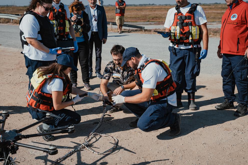
PathoCERT: UAV used for remote mapping and sampling of water
Within the EU-funded PathoCERT project, remote mapping and sampling of water with the use of a drone for the detection of possible pathogen aquatic contamination after heavy rainfall and flooding in Greece were tested and validated. In terms of tangible benefits, the solution provided an easy, fast and secure method for sampling of water in remote areas and one picture offering instant “helicopter view” of the situation. A demonstration of the drone flight and the use of the PathoDRONE water sampling mechanism is provided in the following video:
Water-borne diseases also a risk factor in Europe
While floods have significantly impacted Asia, Africa, and the Americas in the last decade*, Europe is also at risk in terms of water-borne diseases. A study of the 2024 floods in the urban Wrocław agglomeration in Poland found a greater diversity of bacteria with pathogenic potential in flooded topsoil compared to non-flooded sites, demonstrating how flooding can elevate pathogenic microbial risk in environments where humans come into contact with water and soil.** Likewise, analyses of the 2021 extreme summer floods in Central Europe highlight how large-scale flooding events mobilise and redistribute contaminants, biological and chemical alike, across floodplains and water networks, underlining the complexity of ecological and public health hazards during and after such disasters.***
Thanks a lot to our latest associated partner HRT (Hellenic Rescue Team) for sharing this contribution! Do you know any promising drone use cases? Let us know and we might share your experience with the rest of the COLLARIS Network!
* Infectious disease outbreaks in the wake of natural flood disasters: global patterns and local implications - PMC
** Epidemiological insight into bacterial risk associated with flooded areas of city agglomeration (Wrocław, Poland 2024) | Scientific Reports
*** Assessment of the 2021 summer flood in Central Europe
Virtual Booklet On Drone Use Cases
COLLARIS2 will eventually produce a virtual „booklet” with at least 12 drone use cases, aiming to help overcome the lack of sufficient information about operational use cases for drones. The task is part of the project’s work package 3 - support for the uptake of lessons learnt, lead by the Greek Center of Security Studies, KEMEA. Some elements of the use cases may be included in trial scenarios and training materials.
About COLLARIS2
The EU-funded project COLLARIS2 is the successor to COLLARIS (COLLaborative network on unmanned AeRIal Systems) and focuses on the use of UAS (e.g., drones) in the field of civil protection and disaster management. Building upon the results of the COLLARIS Network, this project aims to continue, expand and further develop the already established international network of crisis management and civil protection practitioners, research institutions and public administration. The members of the network collect and transfer knowledge, exchange experiences, skills, good practices and information on operational procedures for the optimal use of drones in crisis management and rescue missions.