Workshop on wildfire early detection systems
The aim of the workshop was to bring together professionals to discuss about the future of early wildfire detection in the Czech Republic.
Wildfires
The aim of the workshop was to bring together professionals to discuss about the future of early wildfire detection in the Czech Republic.
1. Introduction
More than 50 experts in the field of forest fire protection, forest management and nature and landscape conservation gathered at the castle in Křtiny on 25 to 26 June 2025, for a professional seminar on the topic of "Early detection systems for forest fires and possibilities for their implementation in the Czech Republic." The seminar was organized by the Fire Rescue Service of the Czech Republic (HZS ČR) as part of the Wildfire Early Detection System (WEDS) in the Czech Republic project funded by the European Commission through the TRACK 1 grant program. The seminar included not only presentations by leading experts in the field of early detection of forest fires, but also discussions and the sharing of experiences and opinions during work in expert groups.
The expert seminar concluded the first phase of the project, which lasted from January 1 to June 30, 2025, and was mainly devoted to researching available and developing solutions for the early detection of forest fires that could be applied in the Czech Republic. The aim of the seminar was to bring representatives of all interested parties to the negotiating table and enable them to comment on the results of the first phase of the project, share their experience and expertise in the field, and, in particular, obtain expert insight from key players for the second phase of the project, which is to create an action plan for the implementation of early forest fire detection systems in the Czech Republic.
2. Workshop programme
The seminar program was divided into four plenary sessions, which were also broadcast online, and one block of in-person discussions in three working groups. Col. Roman Francl opened the seminar by presenting the WEDS project, its individual stages, and key milestones. In the following first plenary session, representatives from the academic sphere focused on a general introduction to the issue and research into available solutions and principles for the early detection of forest fires. The research revealed almost 30 early forest fire detection systems, which can be divided according to four basic principles into satellite systems, unmanned aerial vehicles, wireless sensor networks, and camera systems.
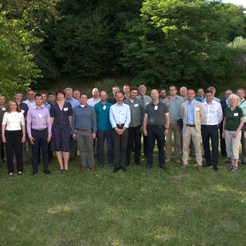
After a coffee break, the seminar program continued with a presentation of specific early detection systems from both a theoretical and practical perspective, including their advantages and disadvantages. Ground-based MESH networks using sensors for forest fire detection were presented, along with a comparison of the parameters of MESH networks and camera detection systems. This was followed by a presentation of detection systems using artificial satellites and an introduction to the DESMOND mobile image detection system. The working part of the first day of the seminar ended with a group photo (see Fig. 1).
The second working day of the seminar began with discussions in three working groups, which addressed the following topics:
During the subsequent plenary session, the chairpersons and rapporteurs of the working groups presented the conclusions of their discussions, which will serve as a basis for further work by the project team, including the creation of an action plan in the second phase of the project.
The seminar was closed by Deputy Director General of the Fire Rescue Service of the Czech Republic, Major General Petr Ošlejšek, Ph.D., with his presentation on the concept of fire prevention and capacity building for fighting forest fires, which should be reflected in the amendment to Act No. 133/1985 Coll. on fire protection.
As stated above, research into available and developing solutions for the early detection of forest fires revealed almost 30 systems, which can be divided according to four basic principles into satellite systems, unmanned aerial vehicles, wireless sensor networks, and camera systems. The following chapters summarize their presentations and the results of the discussions that took place at the seminar.
2.1 Satellite systems
The research found five satellite systems that could be used to detect forest fires, from Germany, the USA, Canada, the UK, and the EU.
The NASA FIRMS satellite system was developed in 2007 by NASA and is designed for global fire monitoring. The primary monitoring technologies are MODIS (Moderate Resolution Imaging Spectroradiometer) and VIIRS (Visible Infrared Imaging Radiometer Suite) satellites, which mainly detect thermal anomalies. MODIS has a resolution of 1 kilometre with satellites flying twice a day. The data is processed on board the satellite and made available within 3 hours of flyover. VIIRS has a resolution of 375 meters, covering the entire world once every 12 hours with two consecutive satellite flyovers 50 minutes apart. The data is also made available within 3 hours of the flyby.
In 1998, the European Commission's Joint Research Centre (JRC) set up a research group to develop and implement advanced methods for assessing forest fire hazards and mapping burned areas on a European scale. This led to the creation of the European Forest Fire Information System (EFFIS) in 2000. EFFIS uses thermal multispectral analysis technology from satellite images and has been part of the EU's Copernicus program since 2015 as part of its emergency management service. Information on active fires is usually updated six times a day. The data is available in EFFIS within 3 hours of the images being taken.
The Canadian WildFireSat system provides high-resolution multispectral images and uses AI for evaluation. The first satellite was launched in March 2025. The aim is to create a network ensuring satellite flyovers every 20 minutes. The detection resolution for fires is 5x5 meters. The system is currently in trial operation.
The German satellite system ORORA evaluates data from 26 satellites, with the company continuously adding new satellites to the system. The system has a resolution of 10x10 meters and a minimum detectable power of 1.8 MW. Results can be notified by email, SMS, or WhatsApp. Currently, the company guarantees 26 flyovers by various satellites per day, with flyovers distributed quite unevenly; the largest gap without a flyover is 5 hours and 48 minutes between 3:52 p.m. and 9:40 p.m. ORORA can identify the burned and affected area, the radiation power of the fire, a list of satellite flyovers, the current weather situation in the affected area, and the expected spread.
The disadvantage of satellite detection in general is that the data takes some time to reach Earth and that it currently only detects relatively intense, developed fires. Current forest fires do not usually produce enough heat to be detected by satellites, and not only in the early stages of fire development. Given the rapid development of technology in recent years, it can be assumed that the level of thermal energy that satellites are able to detect will gradually decrease. Another disadvantage is the relatively large time gap between satellite flyovers.
On the other hand, the advantage is the constant increase in the number of satellites, which will fill the flyover gap in the future, and the low cost of building the infrastructure, as the customer pays for the license and then simply uses the system.
2.2 Unmanned aerial vehicles
The study also identified five systems that can be classified as unmanned aerial vehicles designed for forest fire detection: two from the US and one each from the EU, the Netherlands, and Slovakia. However, a new mobile system for forest fire detection developed by the Czech Fire and Rescue Service, known as the DESMOND mobile image detection system, was presented at the seminar.
This integrated monitoring and detection system consists of a stationary camera and sensors, a mobile monitoring station, and drone units (see Fig. 2). The basic functions of the system are remote visual and thermal imaging monitoring, detection of smoke and temperature changes in the landscape, automatic image analysis (e.g., anomaly detection), and real-time image transmission to the incident commander's headquarters or mobile monitoring station. The system is solar-powered and uses LTE transmission (technology for high-speed wireless data transmission in mobile networks, often referred to as 4G).
The reason for deploying the DESMOND system is to protect protected areas during times of high risk, thereby creating a temporary forward operating base within the mobile command centre, monitoring fires in inaccessible areas where drones cannot be deployed, and monitoring recreational areas during the summer season. In terms of forest fire detection, the DESMOND system can be used for prevention and early warning, monitoring during a fire, and securing critical zones. For prevention and early warning, the system is placed in high-risk locations (dry vegetation, recreational areas). The camera monitors the landscape in high resolution and automatically searches for smoke or thermal anomalies. If a fire is detected, an alarm is sent, and an image is sent to the operations centre. For monitoring during a normal fire, the system is placed at the edge of the fire or at a location from which the fire threatens to spread, providing a visual and thermal overview of the situation without the need to send people into the dangerous area. The image is used for the decision-making process of the incident commander (movement of fire, development of smoke cloud). As part of securing critical zones, the system is used to monitor evacuation routes, residential areas, or valuable forest stands and to detect suspicious behaviour (arson).
The mobile monitoring station, which is part of the DESMOND system, is a special command and control tool used to monitor, analyse, and manage firefighting operations directly in the field. It is a mobile unit equipped with advanced communication, display, and analytical technologies that enable commanders to obtain and evaluate key information in real time. The technical background for coordination activities includes a common communication channel, e.g., an LTE network with priority data transmission from drones and helicopters, visualization software, e.g., a GIS map, into which current positions and images are recorded, data storage or cloud, where videos and thermomap outputs are archived. The mobile monitoring station is the main point of integration for live inputs, decision-making, and guidance.
2.3 Wireless sensor networks
Through research, we managed to find five systems that can be classified as wireless sensor networks (WSN); two from the USA and one each from Canada, Portugal, and Germany. The systems differ in terms of sensor types, data transmission platform, coverage area, infrastructure requirements, response speed, resilience and reliability, autonomy, and false alarms.
In monitored areas, wireless sensors (Wildfire Sensors) detect combustion products, namely H2, CO, CO2, and some VOCs (volatile organic compounds), as well as temperature, humidity, and air pressure. Identification takes several minutes. The sensors "sense" fire as early as the smouldering stage, allowing it to be extinguished before it spreads significantly.
Among wireless sensor networks, the most widespread are mesh networks, which refer to an arrangement of devices that mediate network connections and interconnections between individual devices (up to 100 at a time). For early detection of forest fires, the systems use wireless sensors with IoT (Internet of Things) support, efficient data transmission, and AI (artificial intelligence). Data transmission works on the LoRaWAN platform (low-cost wireless radio technology that allows data transmission over distances of up to several kilometres with minimal energy consumption), IoT, and mesh networks. The system consists of four parts: wireless sensors, mesh gateways, border gateways, and a cloud platform. Sensors and mesh gateways are installed on trees at a minimum height of 3 meters, while border gateways are installed on poles or forest houses. Sensors connected to the mesh network enable efficient data transmission even in remote areas without a mobile signal. Data is transmitted to central servers via LoRaWAN. Data transmission is shown in Fig. 3.
A large installation (covering an area greater than 10,000 ha) for early detection of forest fires requires several thousand sensors, dozens of network gateways, and border gateway units. The biggest advantages of mesh networks include rapid fire detection (they detect fires even before visible smoke appears), a system response time of less than 10 minutes, which allows for a quick reaction to an emerging fire, wireless communication, scalability (the ability to expand the mesh network across a large area by adding sensors), low energy consumption, independence from mobile networks, and rapid alerting of emergency services via SMS, mobile applications, or email. The disadvantages of the system include its vulnerability to vandalism (sensors and network gateways are located on trees), high acquisition costs for extensive coverage, unsuitability for large open areas, dependence on radio signals and connections – satellite communication may be necessary in some remote areas. The energy source is supercapacitors, which store energy from solar panels built intoindividual components of the system.
A large installation (covering an area greater than 10,000 ha) for early detection of forest fires requires several thousand sensors, dozens of network gateways, and border gateway units. The biggest advantages of mesh networks include rapid fire detection (they detect fires even before visible smoke appears), a system response time of less than 10 minutes, which allows for a quick reaction to an emerging fire, wireless communication, scalability (the ability to expand the mesh network across a large area by adding sensors), low energy consumption, independence from mobile networks, and rapid alerting of emergency services via SMS, mobile applications, or email. The disadvantages of the system include its vulnerability to vandalism (sensors and network gateways are located on trees), high acquisition costs for extensive coverage, unsuitability for large open areas, dependence on radio signals and connections – satellite communication may be necessary in some remote areas. The energy source is supercapacitors, which store energy from solar panels built into individual components of the system. R References to existing installations or testing of this system come from Germany (Brandenburg), Spain (Catalonia), Portugal (national parks), Greece (southern part of the country), the USA (testing in California), Canada, Brazil (testing in the Amazon), Indonesia, Australia, and Africa.
2.4 Detection systems using terrestrial cameras
The research found 11 systems that can be classified as camera systems: three from the US, two from Germany and South Africa, and one each from Croatia, Hong Kong, Italy, and Greece.
Camera systems for early detection of forest fires use camera sensors, AI image analysis, and various communication technologies. The system detects smoke using a multispectral sensor that contains four sensor units: optical and IR. The automatic camera system detects smoke even from small fires based on visual (optical) analysis, using AI to analyse and detect smoke. The cameras are located on towers or masts with a good view of large areas. AI and machine learning algorithms analyse the image in real time and look for "smoke patterns." Once the system detects a potential fire, it immediately transmits the data. Where possible, existing telecommunications operator towers, masts, or tall buildings can be used, eliminating the need to build new infrastructure. The cameras are installed on towers 10-50 meters high for optimal visibility. They use optical zoom and rotation, which allows them to cover large areas.
Online data transfer between the camera and the operations or surveillance centre is carried out via microwave connection, mobile networks (4G/5G), fibre optics, or satellite communication. The combination of these technologies enables fast and reliable transmission even in remote locations. Images, videos, GPS coordinates, and AI analyses are sent. The operations centre receives the data and compares it with historical information. Dispatchers or operations officers manually verify the visual evidence and decide whether intervention is necessary. If a fire is confirmed, the system immediately notifies the fire department.
Depending on weather conditions, a single camera can detect a developing fire at a distance of several tens of kilometres. A single camera tower can cover up to 700 km2. Using multiple camera towers, an area of 1,000 km2 or more can be covered. Thanks to AI analysis, high resolution, and optical zoom, the system enables detailed analysis of remote locations.
The system responds in the following steps: smoke detection by the camera takes place immediately in real time, AI image analysis takes tens of seconds, data transmission to the operations centre takes less than a minute, analysis and confirmation by the operations centre takes a few minutes, and the fire department is alerted immediately after the fire is confirmed. The total response time, i.e., the time from detection to the command for the unit to depart, is within 10 minutes. Tower systems can be powered by the electrical grid, solar panels, or battery backups. Detection may be limited by fog, rain, or smoke from other sources. The system can also operate at night thanks to thermal and sensitive night cameras. Versions of the system equipped with thermal imaging sensors can detect thermal anomalies and hot spots even in complete darkness – they must include a near-infrared sensor for night detection. Modern thermal cameras have improved low-light imaging sensors that can capture reflections from fire or hot coals at greater distances. The system analyses rapid changes in light, enabling it to detect flashes of fire in the landscape.
The advantages of camera systems include automatic fire detection 24/7, system autonomy, long range and coverage, fast response, various connection options, early warning, and AI-based smoke detection that can distinguish smoke from fog or clouds. By using multiple sensors, the system combines the advantages of optical smoke detection with those of thermal detection. The system is suitable for large open areas. However, in the national parks of the Czech Republic, it was necessary to build towers to install the system.
References to existing installations of this system include Germany (Saxon Forest, Brandenburg), Slovakia, the USA (California and Arizona), Canada (British Columbia and Alberta), Spain (Catalonia and Andalusia), Australia (New South Wales, Victoria, and Queensland), Portugal, Colombia, and Chile.
A study trip to Slovakia provided very valuable information. Camera systems (automated stationary detection systems) are installed at three locations, namely in the High Tatras, Low Tatras, and Záhorie; they cover a total area of 7,593 km². According to their experience, the system response time is 15-20 minutes, i.e., the time from the outbreak of a fire to the arrival of firefighters. Each location has its own control centre and is monitored by six camera systems; each area has its own GIS. The control centre has five employees and operates 24/7/365. Similar systems are in place in Germany and Poland.
3. Conclusions
The seminar discussed topics such as the implementation and operation of early detection systems in the Czech Republic and the selection of early forest fire detection systems in relation to the nature of the territory, vegetation parameters, and the risk of forest fires.
The conclusions of the seminar indicate that the priority issue for the introduction of an early detection system for forest fires in the Czech Republic is to define the territory we want to protect and the way in which we want to achieve this. In the next stage of the project, its researchers will focus on the suitability of individual systems for different terrain characteristics, for which a comparative evaluation framework will be created. For this tool, the seminar defined the basic technical criteria according to which the systems will be evaluated, such as reliability (false alarms/real alarms), references, response speed, effective coverage, system autonomy, need for new infrastructure, manufacturer credibility, ability to create hybrid solutions, resilience, operating costs, life cycle and costs, reliability of data transmission technology, fire identification and location, and method of verifying results. The next step is to determine which detection systems are most suitable and what their use will provide us with. Each detection system has its advantages and disadvantages and is optimal for different types of terrain.
The seminar provided an opportunity for experts from different fields who shared a common interest to meet and discuss the introduction of an early forest fire detection system in the Czech Republic, as this can significantly speed up the detection of forest fires and enable a rapid response from emergency services, thereby minimizing damage and protecting forest ecosystems. The deployment of the detection system will also reduce damage to firefighters' equipment and enable a faster and more accurate response to fires, which will not have the opportunity to develop significantly, making the intervention of firefighting units much more effective.